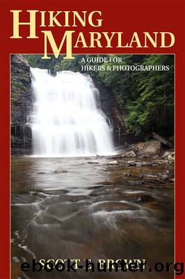
Hiking Maryland: A Guide for Hikers & Photographers by Scott E. Brown

Author:Scott E. Brown [Brown, Scott E.]
Language: eng
Format: azw3
ISBN: 9780811753999
Publisher: Stackpole Books
Published: 2013-12-31T16:00:00+00:00
Cross Blagden Avenue at 1.28 miles, swing left to climb again, and then go right. Arrive at Pulpit Rock at 1.6 miles to find a leaves-off view looking upstream. Now drop to creek level where the pleasant trail descends as it swings left. Beach Drive is in view across the creek, as is a road bridge in the distance. Start another climb-and-drop sequence and pass a side trail on the left to Picnic Area #4 at 2.1 miles.
With Beach Drive on your side the trail is now more or less level all the way to Military Road. There is one minor climb as you approach the tennis center, and then a fence pushes the trail back to the left and downhill again. I had an encounter on this little downhill part with one of trail runningâs three worst critters: the dreaded root snake. I broke a toe on an exposed root but managed to finish the loop, although slowly. (In case youâre wondering, the other two are the infamous rock squirrel and the vicious stump bunny. They are exceptionally nasty animals.)
Arrive at the Park Police Station at 3.0 miles; Picnic Area #5 is ahead near Joyce Road. Youâll have to carefullyâvery carefullyâcross Joyce Road, then head under the high bridge carrying Military Road over Rock Creek. After passing under Military Road at 3.14 miles, donât bother trying to find the blue blaze that heads right to the switchback uphill (as shown on the NPS map). Instead, go straight along Beach Drive to the bathrooms near Picnic Area #6 and the Miller Cabin. Here, you can fill water bottles. A few yards past the bathrooms, follow the little footpath that goes right, and hit the blue blaze a dozen yards later. Go left.
As you move along, the golf course will be out of view to the right and youâll see a âNo Trespassingâ sign behind the green for #14. Shortly after, the Black Horse Trail joins from the left at 3.5 miles. Arrive at Rolling Meadow Bridge at 3.8 miles. Pause here and walk to the bridgeâs middle for a nice view of Rock Creek. Return to the trail and continue north, passing the Whittier Trail at 4.1 miles, then pass under the Sherrill Drive Bridge at 4.2 miles.
The trail is flat from here to Boundary Bridge and parking area CT 1, running along a mud bank several feet above the creek. There are numerous little jogs, twist, side trails, and braids, so stick with the widest and most-used path. Whether running or walking, you can set a brisk pace, even if the surface is muddy. From Sherrill Drive youâll pass the Holly and Pine Trails at 4.3 and 4.9 miles, respectively. The blue-blazed trail makes an odd loop away from Rock Creek just north of the Pine Trail at 5.0 miles. The next landmark is West Beach Drive at 5.5 miles; pass under it and bear left just before CT 1 on a side trail. Arrive at Boundary Bridge and CT 1 at 6.
Download
This site does not store any files on its server. We only index and link to content provided by other sites. Please contact the content providers to delete copyright contents if any and email us, we'll remove relevant links or contents immediately.
In a Sunburned Country by Bill Bryson(3451)
Annapurna by Maurice Herzog(3398)
How to Read Nature by Tristan Gooley(3213)
Dangerous Girls by Haas Abigail(2923)
SAS Survival Handbook by John 'Lofty' Wiseman(2634)
The Lost Art of Reading Nature's Signs by Tristan Gooley(2584)
In the Woods by Tana French(2496)
The Stranger in the Woods by Michael Finkel(2371)
Food and Water in an Emergency by Food & Water In An Emergency(2306)
Guns, Germs and Steel by Diamond Jared(2238)
Everest the Cruel Way by Joe Tasker(2210)
Wild: From Lost to Found on the Pacific Crest Trail by Cheryl Strayed(2176)
Backpacker the Complete Guide to Backpacking by Backpacker Magazine(2151)
Trail Magic by Trevelyan Quest Edwards & Hazel Edwards(2106)
Ultimate Navigation Manual by Lyle Brotherton(2081)
Sea Survival Handbook by Keith Colwell(2080)
Welcome to the Goddamn Ice Cube by Blair Braverman(1933)
Birds of the Pacific Northwest by Shewey John; Blount Tim;(1902)
The Last Flight by Julie Clark(1880)
